Nineteen point four four kilometres. Eleven hundred and forty-six metres of gain. A 5.9 percent average from Briançon to the summit at 2,356 metres. On paper, the Col d'Izoard from its northern side reads like a long, patient Alpine climb — the kind a strong club rider dispatches without drama. That reading survives until you round the last bend below the summit and the road opens onto the Casse Déserte, and the climb you thought you were doing turns into the climb the Tour de France has been photographing since 1922.
The Numbers Say One Climb, the Casse Déserte Says Another
We measured this ascent from Briançon before we drew it, and the profile behaves. It starts at 1,210 metres — already high, which matters for how the body works before the first pedal stroke — and finishes at 2,356 metres. Across 19.44 kilometres it gains 1,146 metres, and if you took that number at face value you would slot the Izoard from Briançon somewhere between the northern Télégraphe and a mid-tier Pyrenean pass. A long climb with a moderate hand. Nothing that demands a specific gear choice or a specific fitness threshold. Nothing, in the abstract, that would justify a hundred years of Tour de France photography.
The Casse Déserte is the reason the abstract collapses. In the final kilometres before the summit, the road pulls out of the last band of larch and pine and enters a landscape that looks nothing like the rest of the climb. Orange-yellow scree, eroded dolomite spires, no vegetation of any consequence — a moonscape sitting at over 2,300 metres, ringed by mountains that behave the way mountains are supposed to behave. The transition is what makes the Izoard the Izoard. You climb through a normal Alpine valley for the better part of nineteen kilometres and then the road drops you into something that reads as geology rather than terrain.
The trouble with writing about this from our desk is that the profile does not know about it. A satellite dataset like the OpenTopoData SRTM 30 m grid we work from can tell you exactly how much altitude the road gains between two points; it cannot tell you that at kilometre eighteen the visual context of the ride changes so completely that riders describe the last section as a different climb entirely. This is the gap between measurement and experience that a climb print is always trying to hold together, and the Izoard is one of the mountains where the gap is widest. The numbers are honest. They are also incomplete.
If you were selling this ride to a friend on statistics alone you would probably not sell it. Nineteen and a half kilometres at 5.9 percent — there are dozens of Alpine climbs that read like that. The reason people come is that the last two kilometres do not read like anything else in France, and the memory of those two kilometres retroactively colours the eighteen that preceded them. A rider who has done the climb will tell you it felt harder than it is on paper. A rider who has not done the climb, and who trusts the paper, will underestimate what the mountain does to the mind between the treeline and the summit.
A 5.9 Percent Average Hides Where the Izoard Actually Bites
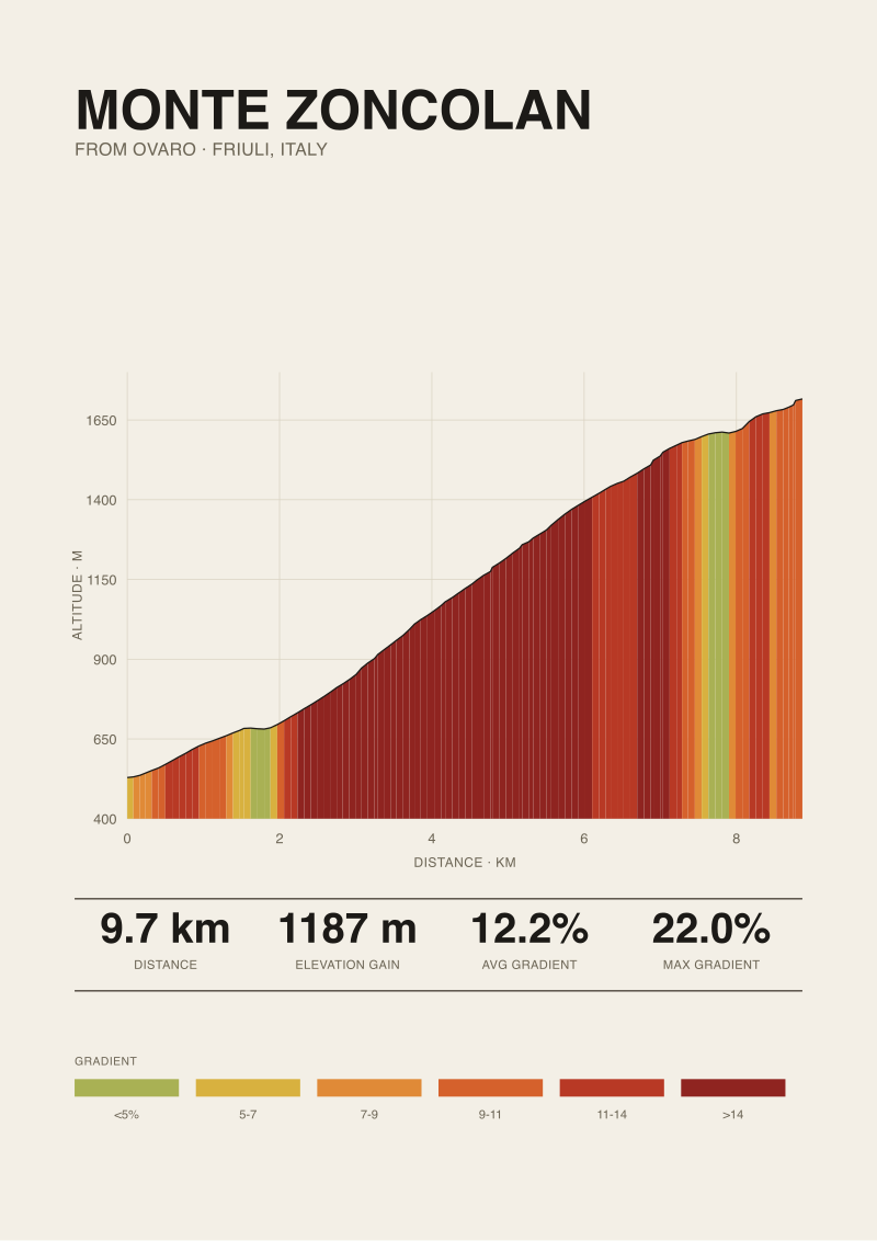
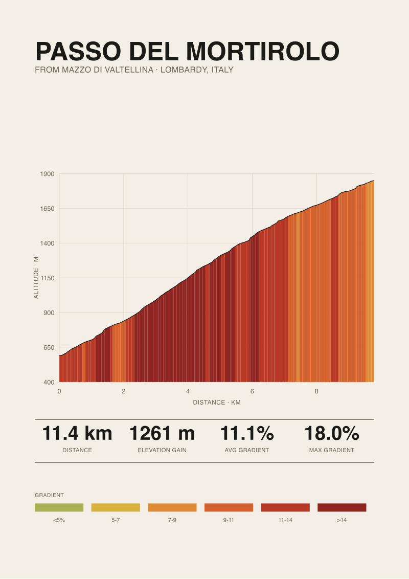
The published maximum gradient for the Briançon ascent is 9.4 percent, per climbfinder.com. That is not a huge maximum by Alpine standards — the Angliru's certified maxima are past 20 percent, the Zoncolan's are past 22, the Mortirolo touches 18 in its statistical passages. Nine point four, in isolation, sounds gentle. Held against a 5.9 percent average across the whole climb, it sounds gentler still. This is where most readings of the Izoard from Briançon go wrong.
The 5.9 percent average is a mathematical artefact of the way the climb is built, not a description of what any given kilometre feels like. The road from Briançon does not gain altitude uniformly. There is a long, almost transitional opening section that follows the valley through Cervières, sitting well below the average, and then the profile steepens as the road turns south and starts climbing in earnest toward the pass. The steep sections do not distribute themselves politely across the length of the ascent; they cluster. A climb whose average is 5.9 will have kilometres that are 3 and kilometres that are 8, and it is the 8s that determine how the day goes.
We should be honest about a discrepancy here. Our elevation profile is drawn from satellite data at 30-metre resolution — that is what OpenTopoData SRTM 30 m gives us. Published road-book figures for the maximum gradient, including the 9.4 percent from climbfinder, are typically derived from finer-grained on-road measurement or from the road-book publisher's own dataset. The two can disagree by tenths of a percent, occasionally more, depending on how a short steep pitch happens to fall within a 30-metre pixel. For a print, this rarely matters. For a rider standing at the base wondering what gear to fit, it matters less than most riders think — the felt gradient of a climb is set by the sustained sections, not by the one pitch that briefly touches a maximum. The 9.4 is a reference number. The kilometres in the low-to-mid eights are the ones that write the day.
What the average also hides is the altitude. The summit sits at 2,356 metres, which is high enough that oxygen availability becomes part of the equation for most riders in the last third of the climb. A gradient that would feel routine at sea level does not feel routine at two thousand metres. This is not something you can read from a profile line either — the profile shows altitude on the y-axis, but it does not show what altitude does to your legs. The Izoard from Briançon starts high and finishes higher, and the physiological weight of that starting altitude compounds through the day. Riders who arrive from lowland training grounds and treat the climb as a 5.9 percent average almost always report the same thing: the last four kilometres felt disproportionate. They were.
The other invisible variable is wind. The Casse Déserte is exposed in a way that nothing lower on the climb is, and the geometry of the pass means a headwind on the final approach can turn a manageable gradient into something else. We cannot draw wind on a profile. We can only note that a climb whose last passages happen above the treeline in a shallow bowl of eroded rock will present itself very differently on a still afternoon and on a day when the mistral is running down the valley.
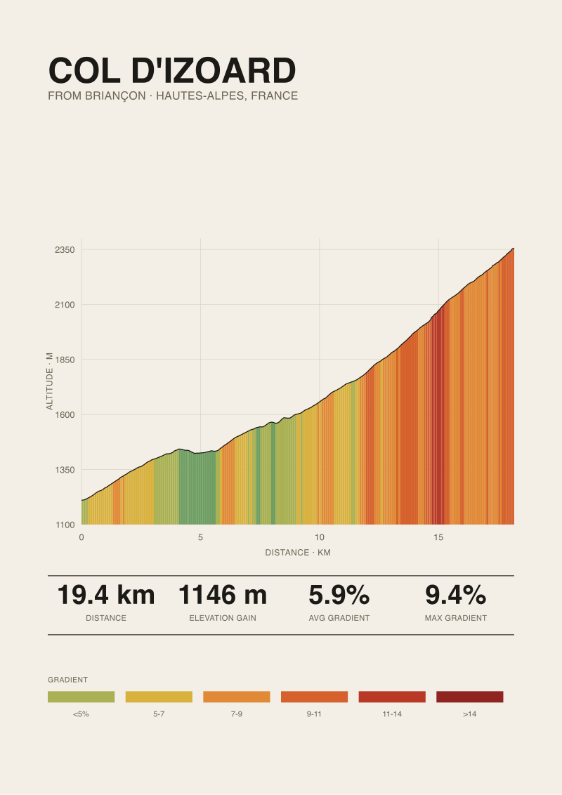 Col d'Izoard
The print from this article · from €29.95
View the print →
Col d'Izoard
The print from this article · from €29.95
View the print →
The Mountain Coppi and Bobet Made Famous Is the One You See, Not the One You Climb
The Col d'Izoard has been in Tour de France route books for over a century. Fausto Coppi rode over it decisively in the late 1940s and again in the early 1950s. Louison Bobet built part of his legend on the same road in the mid-1950s. There is a monument to both riders on the Casse Déserte itself, placed in the moonscape rather than at the summit, which tells you something about how the mountain organised its own memory. The plaque is where the photograph is, not where the road tops out.
This distinction is worth sitting with, because it explains why the Izoard has kept its cultural weight even in decades when the Tour has skipped it or used it as a mid-stage climb rather than a summit finish. The mountain that became famous is the one that photographs — the eroded scree, the spires, the black-and-white images of a solitary rider crossing what looks like a Martian landscape in wool. The mountain that is actually climbed, in a stage or on a Tuesday morning in July with a bidon and a friend, is a nineteen-kilometre ascent that gains 1,146 metres at a reasonable average. Both are true. The photographic mountain is the one the sport remembers. The measured mountain is the one you have to ride.
For the Tour, this has consequences that occasionally frustrate purists. A stage that finishes on the Izoard has, in recent decades, tended to produce time gaps in the tens of seconds rather than the minutes that older stages produced. The gradient does not sort a modern peloton as brutally as the Angliru or the Zoncolan can. The altitude helps, the length helps, the accumulated fatigue of a stage arriving at its base helps — but the climb itself, in raw selectivity terms, is not the guillotine that its mythology sometimes implies. The mythology was built in an era of heavier bikes, worse road surfaces, and racing that started earlier in the day and ended later. The mountain has stayed the same. Everything around it has changed.
What has not changed is the visual experience. Roll into the Casse Déserte on any bike, at any pace, and you are inside the same landscape Coppi rode through. The road has been resurfaced, the equipment is unrecognisable, the racing is a different sport — but the eroded orange-yellow rock, the spires, the strange silence of a place that plants have decided not to inhabit, all of that is intact. This is one of the reasons we make prints of it in the first place. There are climbs whose story is entirely in the numbers, and climbs whose story is entirely in the geology, and a small number where the two stories argue with each other. The Izoard is one of that small number. If a print of the profile hangs on a wall alongside a print of any other Alpine climb, only one of them makes you stop and ask what happened up there near the summit; if you want the one that does, we keep it at the studio shop.
This is what we mean when we say the Izoard from Briançon rewards a reader who knows how to hold two things at once. The 19.44 kilometres, the 1,146 metres of gain, the 5.9 percent average, the 9.4 percent maximum — these are the facts of the climb. The Casse Déserte, Coppi's monument, the photograph the sport has been taking for a hundred years — these are the facts of the mountain. A rider planning the day needs the first set. A rider trying to understand why the mountain matters needs the second. The profile print exists in the seam between them, which is why it takes both to draw one properly.
This piece started as a straightforward technical read of the northern ascent — kilometre by kilometre, gradient by gradient — and turned, once we put the numbers next to what the mountain actually looks like above 2,300 metres, into an argument about what an elevation profile can and cannot tell you. The measured Izoard is honest and unremarkable. The Izoard the sport remembers is neither. Any climb print of this mountain is really a print of that argument, held on one sheet.
FAQ
How long is the Col d'Izoard from Briançon exactly?
Our measurement, drawn from OpenTopoData SRTM 30 m elevation data, puts the northern ascent at 19.44 kilometres from the town of Briançon to the summit at 2,356 metres. Total elevation gain over that distance is 1,146 metres. Start elevation is 1,210 metres, which is worth noting on its own — the climb begins high enough that altitude is already a factor for riders coming from lowland training grounds, before the first ramp has done any real work.
What is the average gradient, and does the average tell the truth here?
The average gradient across the full 19.44 kilometres is 5.9 percent. That number is mathematically correct and practically misleading. The climb has a long, near-transitional opening section through Cervières that sits below the average, then steepens materially as the road turns toward the pass. Averages compress this kind of profile into a single figure that describes no single kilometre. The climb is easier than 5.9 percent in its first third and harder than 5.9 percent in its last third.
What is the steepest section, and how much does it hurt?
The published maximum for the Briançon side is 9.4 percent, per climbfinder.com. By Alpine standards that is a moderate maximum — nowhere near the double-digit sustained pitches of Angliru, Zoncolan, or Mortirolo. What makes the steep sections bite on the Izoard is not their raw gradient but their placement in the last third of the climb, after eighteen kilometres of accumulated fatigue and at altitudes above 2,000 metres where oxygen availability starts to matter.
Why is the Casse Déserte so famous if the climb itself is not the steepest?
The Casse Déserte is the eroded moonscape in the final approach to the summit — orange-yellow scree and dolomite spires above the treeline. It became the mountain's visual signature because it photographs unlike anywhere else in French cycling, not because it selects riders more brutally than other climbs. The Tour de France has been photographing this landscape since 1922, and Fausto Coppi and Louison Bobet both raced through it decisively enough that a monument to them sits in the moonscape itself, below the summit.
Where does the elevation data in this article come from?
We use OpenTopoData's SRTM 30 m grid to measure ascents before we render them as prints. That data is derived from satellite radar and resolves elevation at 30-metre horizontal pixels. It agrees with on-road road-book measurement within tenths of a percent for average gradient and within similar tolerances for total gain. The published maximum gradient of 9.4 percent we cite comes from climbfinder.com's Briançon entry, which uses a different dataset — we name the source because the two occasionally disagree on very short pitches.
Is the Izoard from Briançon a good first Alpine climb?
It is a defensible first Alpine climb for a fit club rider, with two caveats. The first is altitude — starting at 1,210 metres and finishing above 2,300 puts most of the effort in air that lowland riders are not adapted to. The second is exposure — the Casse Déserte sits in a shallow bowl above the treeline, and wind on the final approach can change the day. Neither caveat is disqualifying. Both are worth planning around.
How does the Briançon side compare to the southern ascent from Guillestre?
The two sides of the Izoard are different climbs sharing a summit. The Briançon (northern) side is the one covered here — 19.44 kilometres, 1,146 metres of gain, 5.9 percent average. The southern ascent from Guillestre is longer and has its own profile character; we do not have its measured figures in the grounding for this article and would rather stay silent than approximate. If we publish a piece on that side, its numbers will come from the same measurement pass, not from memory.
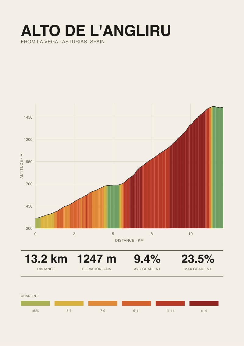 Alto de l'Angliru
The print from this article · from €29.95
View the print →
Alto de l'Angliru
The print from this article · from €29.95
View the print →
From the collection

New climbs and 10% off your first print.
One email now with your code. No noise after.